


Website template
Isoline
A light, survey-sheet site for climate and risk data, with a live contour map that lifts under the pointer and stands up into a terrain model as you scroll.
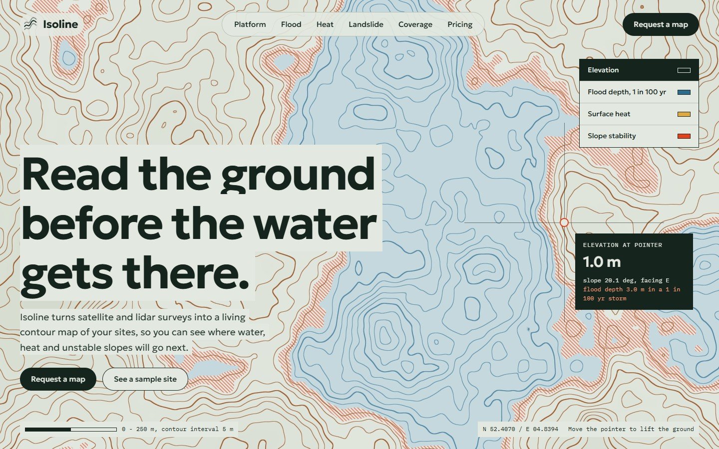
Isoline is a premium one-page website for flood and climate risk companies, survey firms and land data products. The hero is a full-screen live contour map: brown contour lines every 5 m, pale blue water and orange hatching on the shore at risk. The ground lifts in a soft hill under the pointer while a crosshair card reads the elevation, slope and flood depth of that spot, and a layer switch re-colours the same map for flood depth, surface heat or slope stability.
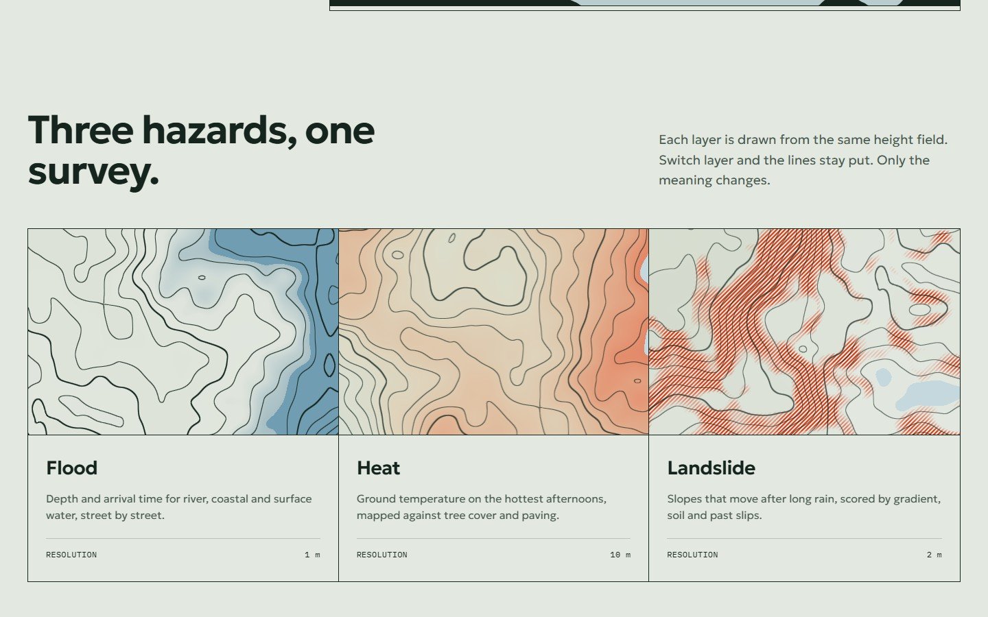
Scroll, and the same map tilts to a side view: every contour lifts to its real height, then water rises through the model to a storm level, with an elevation profile below. Then three hazard cards drawn from the same ground, a section where the whole page turns dark with a list of sites and their status, and a request form that works with Netlify Forms.
Features
- Live WebGL contour map with even-width lines, water, shore risk hatching and a hill that follows the pointer (tap on phones)
- Crosshair card with elevation, slope and flood depth read from the same ground as the picture
- Working layer switch: elevation, flood depth, surface heat and slope stability, with a short crossfade
- Pinned scroll scene: the flat map tilts into a terrain model, then water rises to a storm level, with a live profile strip
- The whole page turns dark at the updates section and back again
- Three hazard cards with live crops of the same landscape
- Request form ready for Netlify Forms, with notes for Formspree and mailto
- Fonts stored in the kit: nothing loads from other servers
- Settings at the top of the CSS and JS: brand, landscape, layer, pointer, water rise, motion
- 2D fallback without WebGL; complete still version for reduced motion; pauses off screen; adapts sharpness to the device
The prompt
You are building a premium one-page website template called "Isoline" for a fictional company that turns satellite and lidar surveys into living contour maps that show flood, heat and landslide risk. It is a LIGHT design that looks like a printed survey sheet: paper #E3E8E0, ink #15251E, contour brown #9B5A2C, water blue #2B6C8E, risk orange
Full prompt, 9 steps, opens after you buy or claim Locked
How to use
- Open the prompt, or download the source code, from My library.
- Paste the prompt into Claude, or upload the files to your web host.
- Change the settings block: your name, colours, texts and pictures.
- Preview it in your browser and check it on your phone.
- Publish it on your own domain.
What is inside
- Source files: index.html, assets/css/style.css, assets/js/main.js, assets/js/terrain.js, assets/fonts/
- Prompt pack (Markdown and PDF): rebuild or adapt the design with Claude, step by step
- Set-up notes (Markdown and PDF): normal web host, Netlify, and the form (Netlify Forms, Formspree, mailto)
- README with every setting explained
- LICENSE.txt and CREDITS.md
Files
- isoline-v1.0.0-full.zip Source code, 327 KB Scanned, clean
- isoline-v1.0.0-prompt-pack.zip Prompt, 232 KB Scanned, clean
- PROMPT-PACK.pdf Prompt, 152 KB Scanned, clean
- SETUP.pdf Set-up notes, 62 KB Scanned, clean
Technical details
- Plain HTML5, CSS and JavaScript; WebGL for the map and terrain, Canvas 2D for the profile and the fallback (no library)
- Fonts: Geologica and IBM Plex Mono (SIL Open Font License), included as files
- Works in current Chrome, Edge, Safari and Firefox, desktop and phone
- Tested at 1440, 1024, 768 and 390 px wide
Licence
- You may
- Use it for your own websites and for client websites, as many as you like, and change anything
- You may not
- Resell or share the template files or the prompt pack
- Updates
- Free, they appear in My library
- Refunds
- Only if a file is faulty and we cannot fix it